
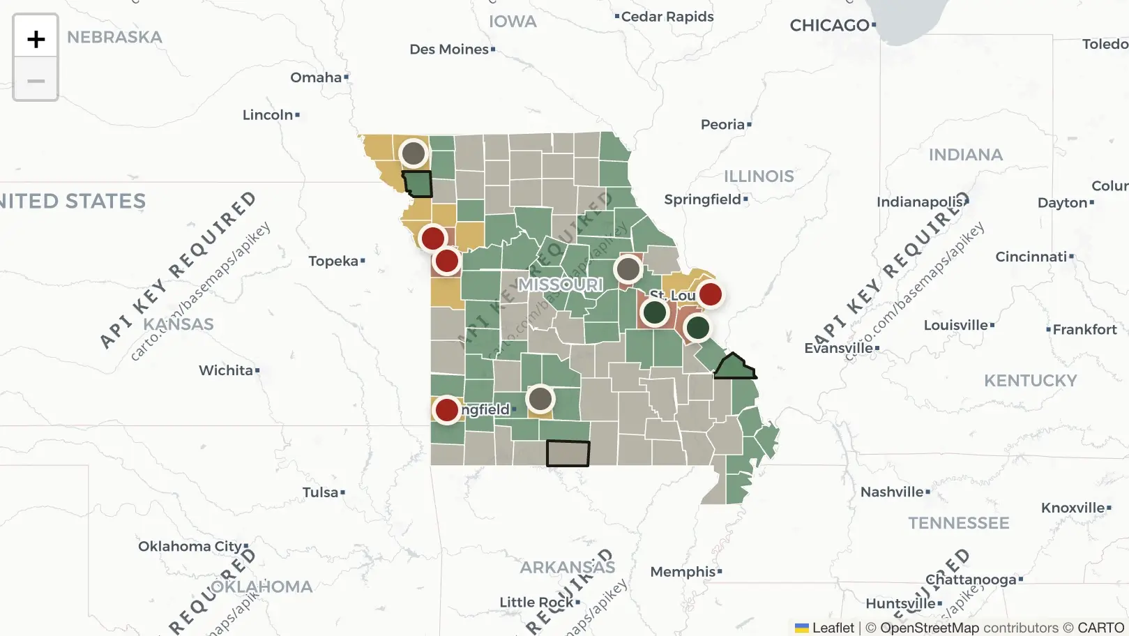
In Franklin County, Missouri, hundreds of acres of farmland will be transformed into two large-scale data centers. County leaders approved a multibillion-dollar proposal for two data centers. The first will include 13 buildings, and the other, 16-buildings. Both sites are mere miles apart, and County Commission approval comes despite People’s objection.
According to the St. Louis Post-Dispatch, around 150 people attended a town hall meeting to discuss the data centers. The meeting lasted hours. Commissioners did not explain why they voted yes. Representatives of the data-center building developers, Provident and Beltline Energy, did not answer any questions either. Resident Samantha Krooks is the fifth in her family to live on their dairy and cattle farm. It shares a property line with the future Provident site, and developers have not said which companies will use it. Krooks said, “we’re hearing from people who are already next to a data center about the noise, the air pollution, and the lights. We’re hearing about how their livestock are being affected, and that is really scary for us.”
A February 2026 report by the Missouri Department of Conservation says the Beltline Energy project could jeopardize the habitat of bald eagles, as well as several endangered or threatened species of bats, fish, mussels, crayfish and plants along the Meramec River.
The report also says that forested areas within the project landscape provide buffer zones, or corridors, along the river that mitigate flooding and erosion impacts. Introducing sediments, chemicals, and pollutants can destabilize those corridors and harm species within them. “Data centers represent a rapidly expanding sector of Missouri’s economy. As with other large-scale industries, their growth may outpace comprehensive understanding of associated environmental impacts.”
The Beltline Energy data-center would be placed just 15 miles away from the Big Muddy National Fish and Wildlife Refuge. Provident is 17 miles away. Wildlife refuges rely on their connection to the surrounding landscape because animals move freely across boundaries and depend on regional ecosystems to survive.
Risks in Local Counties
An independent data-center tracker, Missouri Data Centers, ranks counties based on their risk of data centers. The figures are calculated based on power availability, water capacity, land availability, and proximity to active projects. Gray counties are at low risk, green is moderate, yellow is high, and red is very high.
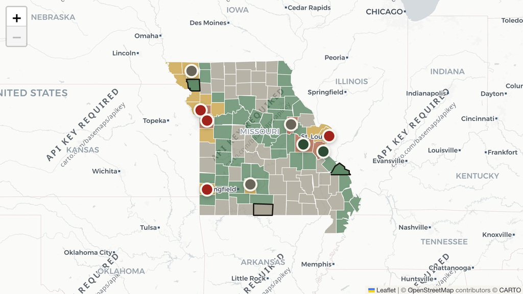
Missouri Data Centers places Scott, New Madrid, Mississippi, and Cape Girardeau Counties in the moderate range with 45-47% risk.
The largest driver of risk in our region comes down to water access. A single hyper-scale data center can require 1-5 million gallons of water a day for evaporative cooling. The Mississippi River provides ample water for this. Developers look for proximity to water when considering hyper-scale data center sites. However, large water withdrawals require DNR permits, and flood risk along the Mississippi River corridor causes problems for ground-level facilities.
Mississippi County scored quite high on land availability. However, our region’s “moderate” risk level comes from the fact that no active projects are yet nearby or proposed. If one single developer makes an announcement, that could change.
Leave a Reply